
Long mocked at its launch, Apple’s Plans app has become an excellent navigation tool — often underestimated out of habit. Precise guidance, public transport, radar and incident reports, offline maps, privacy respect: it has serious arguments, and it’s already on your iPhone. This guide covers everything it can really do, with settings and tips that transform your trips — by car, on foot, or by public transport.
Everyday guidance
For the most part — getting from point A to point B — Plans does the job well: real-time traffic routes, choices between multiple routes with their durations, clear voice guidance, lanes to follow displayed as you approach complex intersections. The reports enrich the journey: radars, accidents, checks reported by the community appear on the road, and you can report them yourself with a gesture. The arrival is well-handled: parking location, last walking section if needed. For the vast majority of trips, everything is there.

Plans helps you navigate daily routes with real-time traffic updates, accident reports, and clear directions. It even shows you the best lanes to take at complex intersections and helps you find parking when you arrive.
Imagine you’re driving from Paris to Lyon. Plans will show you the fastest route, alert you to a traffic jam near Dijon, and guide you to the nearest parking spot in Lyon. It even tells you which lane to take when merging onto the highway.
More than just driving
Plans also shines off-road:
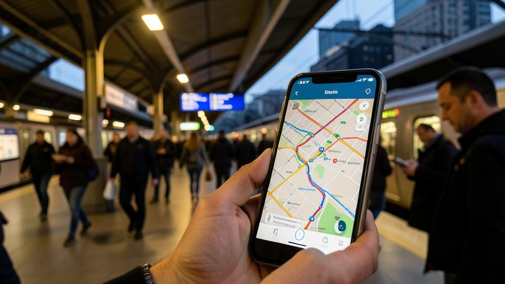
- Public transport: routes combining metro, bus, train, with schedules and connections — and the indication of the nearest station exit to your destination, a detail that changes everything in large stations.
- On foot: realistic pedestrian routes, and in some cities an immersive view to orient yourself at intersections.
- By bike: adapted routes, taking into account the slope and cycling facilities depending on the area.
The multimodal reflex — comparing car, public transport, and walking before leaving — often reveals surprises: in the city, the car is not always the fastest.

The right reflex. Save your key locations — Home, Work, children’s school — in your addresses: guidance then starts in two gestures (« Route to home »), Siri understands them (« Take me to work »), and the app proactively warns you of travel time according to traffic. It’s the basis of frictionless navigation.
Features that make the difference
A few features are worth a detour. The offline maps: download an area (city, vacation region) and navigate without a network — precious abroad or in dead zones. The guides and place lists: prepare a trip by pinning restaurants and visits in a shareable list. The step reporting: add a gas station or restaurant on your route without leaving the guidance. And privacy, a key argument: trips are not linked to your identity, a notable difference with other mapping services whose model relies on the exploitation of movement data.

On the car screen and on the wrist
Plans takes on its full dimension on the vehicle screen: clear interface, guidance on the dashboard, voice commands — safety and comfort both benefit. On the wrist, the watch vibrates differently depending on whether you need to turn left or right: you can navigate on foot without looking at the screen, precious on a bike or in crowded streets. This continuity between devices — preparing the route on Mac, launching it on iPhone, following it on the wrist — is one of the real strengths of the ecosystem.
To anticipate. As with any navigation, keep a minimum of critical thinking: a route can be disrupted by recent work or an exceptional closure not reported. For a critical appointment, plan a margin, and in very isolated areas, download the offline map before leaving — the network, on the other hand, makes no promises.

Frequently asked questions
Is Plans worth other navigation apps?
For daily navigation (car, public transport, on foot), yes, widely — with a real plus on ecosystem integration and privacy. Other services retain specific advantages (detailed reviews, less covered areas): nothing prevents you from crossing them according to your needs.
Do offline maps consume a lot of space?
It’s proportional to the chosen area: a city remains reasonable, a large region weighs more. Download over Wi-Fi before departure, and delete upon return if space is lacking.

Can I avoid tolls or highways?
Yes: route options allow you to avoid tolls and highways, occasionally or by default. Practical for leisure trips or tight budgets.
What to remember
Plans has become a complete and reliable navigation app: precise guidance with traffic and reports, public transport with connections and station exits, pedestrian and bike routes, offline maps for areas without network, and real restraint on your data. Configure your key addresses for two-gesture guidance, use the watch for walking trips and the car screen for driving, and download your maps before trips. Already installed, perfectly integrated, respectful of your privacy: it deserves a second chance — many don’t go back.

Need support with your everyday tools?
Leave a Reply
You must be logged in to post a comment.